

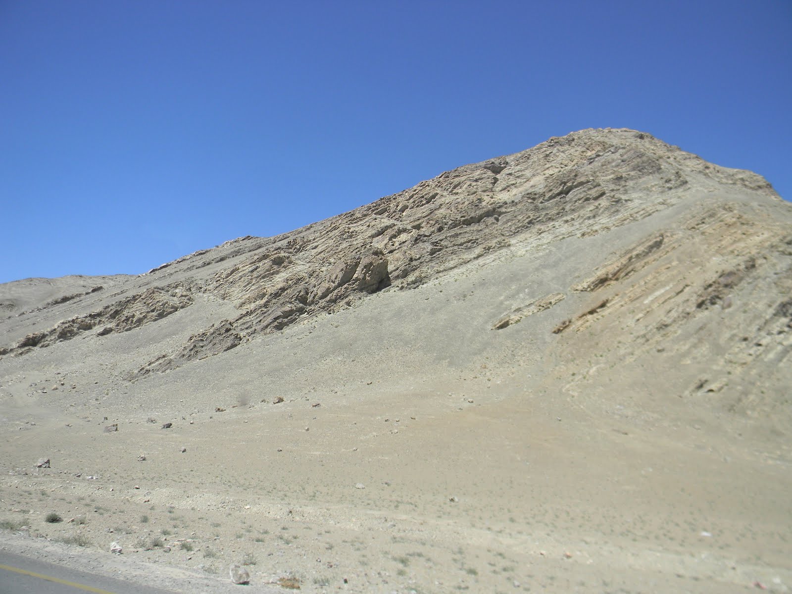
Lamayuru - the Moonland. Continental drift made sure that the Himalayas became the youngest fold mountains in the world. The Himalayas are made up of the marine sediments that came from the ancient Tethys Sea. Lamayuru is one such place which, though not unique, gives a very clear example of badlands or wastelands formed by gullies or running water. Here, once again, the underlying hard rocks have been exposed, leaving tall columns of sandstones standing behind.
The Lamayuru Monastery stands on one such patch of badland. Monasteries dot the Ladakhi landscape like patches of bright colour in the otherwise grey, barren area. Built in the 11th Century, this is the oldest and the largest standing gompa in Ladakh.
Fatula Top, as you can see, is the highest point on the Leh - Srinagar highway. The winds here are very strong and persistent. You will pass through many such passes on the way. Namik la is the 2nd highest pass (12,139 feet above the sea level) on this route.
Moving over wind and water erosion, you will also see examples of glacial erosion throughout the road. As you can see in the above photos, the glaciers have eroded the mountains to form arêtes (sharp mountain ridges), cirques (deep hollows formed near mountain tops) and horns (or pyramidal peaks). The lower part of the mountain is mostly scattered with glacial moraine (stones and gravel transported downstream by glaciers).
These particular mountains appeared to be another glacial depositional landform, namely 'Drumlins'. These are elongated mountains, generally formed of boulder clay deposited by glacial transportation processes. They have smooth tops and when looked at from a vantage point, look like a basket of half-buried eggs.
Farmlands, cultivated on Piedmont plateaus, often break the monotony of the barren panorama. Towns on the highway are far and few in between. Actually, after a while, you might get an impression that there are more Army cantonments and Army men living close to the highway than locals.
The statue of Future Buddha is carved in a mountain in Mulbekh. This is a quaint town located about 1 hour before Kargil. Here, you can also enjoy some refreshing Kahwa or Kashmiri masala tea. Also, try the 'Garlic soup' for some instant dose of O2. This was our last stop before reaching our hotel in Kargil.
Hotel Rangyul, about 8 km before the main town of Kargil, was our home for the night. With a view like that for our company, what else could we ask for? A quick walk in the surrounding areas told us that we were surrounded by mustard fields. Sunlight doesn't dim in these regions till about 8 p.m. in early June. As soon as the night falls, you are overwhelmed by cold and chilly winds. Hence it is important to cover every part of your body by as many layers as possible. Food-wise, do not expect anything great, but basic Punjabi food.
P.S. POK was just 2-3 km away from our Hotel.
Our first glimpse of the famous town of Kargil on the banks of the fast flowing River Suru (a tributary of the River Indus). This river has such high velocity that it carries a lot of silt and load along with it, making it look grey in colour.
Terminal glaciers with moraine on the banks of the river. The temperature outside was just 2-3 degrees Celcius. At many places, the glaciers were melting, creating fresh, foamy, snow-white streams of water and waterfalls.


The Kargil War Memorial was our last stop in the Drass valley. The mountains that are seen behind are the very mountains on which the historic Indo-Pak war was fought. Pakistani infiltrators had captured more than 160 snow covered high peaks during the winters of 1999. That, inspite of the pact between the two armies to leave the high altitudes during the biting cold winters and retreat to lower passes. The Indian army, lead by many great generals captured back all these posts within 3 months, thus saving the Leh - Srinagar highway from going under the control of the enemy. This memorial stands to salute the bravery of those very brave hearts. Imagine a soldier on duty narrating the Kargil war story to you, the goosebumps you feel, standing on the very land, looking at the dangerous mountains behind, imagining the sacrifice of those young soldiers, who died for their nation, for us...
This particular feature is a tribute to all those brave soldiers who guard our border in the most difficult of terrains. They die, with the hope that we will live a little longer! A big salute to their families!
Jai Hind!


Masta...
ReplyDeleteThank you😀
DeleteAmazing write-up Richa Karve. I visited it last year, but while reading, felt as if I am actually travelling their all again.
ReplyDeleteNext time instead of Leh-Srinagar High, prefer going via Daha-Aanu & Batalik. U will love to see Red Aryans and their lifestyle.
Thank you Chandu...and thanks for the suggestion! Sure will...Ladakh can hardly be covered in just one trip!
DeleteGreat going Richa!!
ReplyDeleteLoved the way you name each rock formation and explain what it means in layman's terms. It got me to look at each picture minutely to try and identify the formations. It piqued my interest and brought life and beauty into the otherwise barren landscape of Ladakh. Beautiful pics too!!!
Keep writing!!!
Anush
Thank you so much Anush ma'am! Glad you enjoyed reading it!
DeleteHey,Miss I liked your photography and as always your way of explanation is always best....(Be it classroom or here..)
ReplyDeleteOnce Again Thank you so much for this useful information.. Keep writing..
Karan.
Great feature Richa -- wish geography was taught like this and tributes paid like this....
ReplyDeleteIt must be my extreme good luck to have got a chance to see such a useful article about National Highway 1. share more such articles so that I can better insight.
ReplyDeleteYou can check this blog which is an dedicated to Geography Course (B.A, B.Sc) related books.
THE METHODS AND MATERIALS OF DEMOGRAPHY
The irrational number system by E. L Milne
A geography for beginners by Stewart
and more
Thanks a lot for the kind words!!
DeleteI've been a loyal customer of your travel company for years, and every trip has been a fantastic experience. Your attention to detail and customer service are top-notch! Read this article Essential Bike Gear For Ladakh
ReplyDelete